Maritime Domain Survey – Istria County
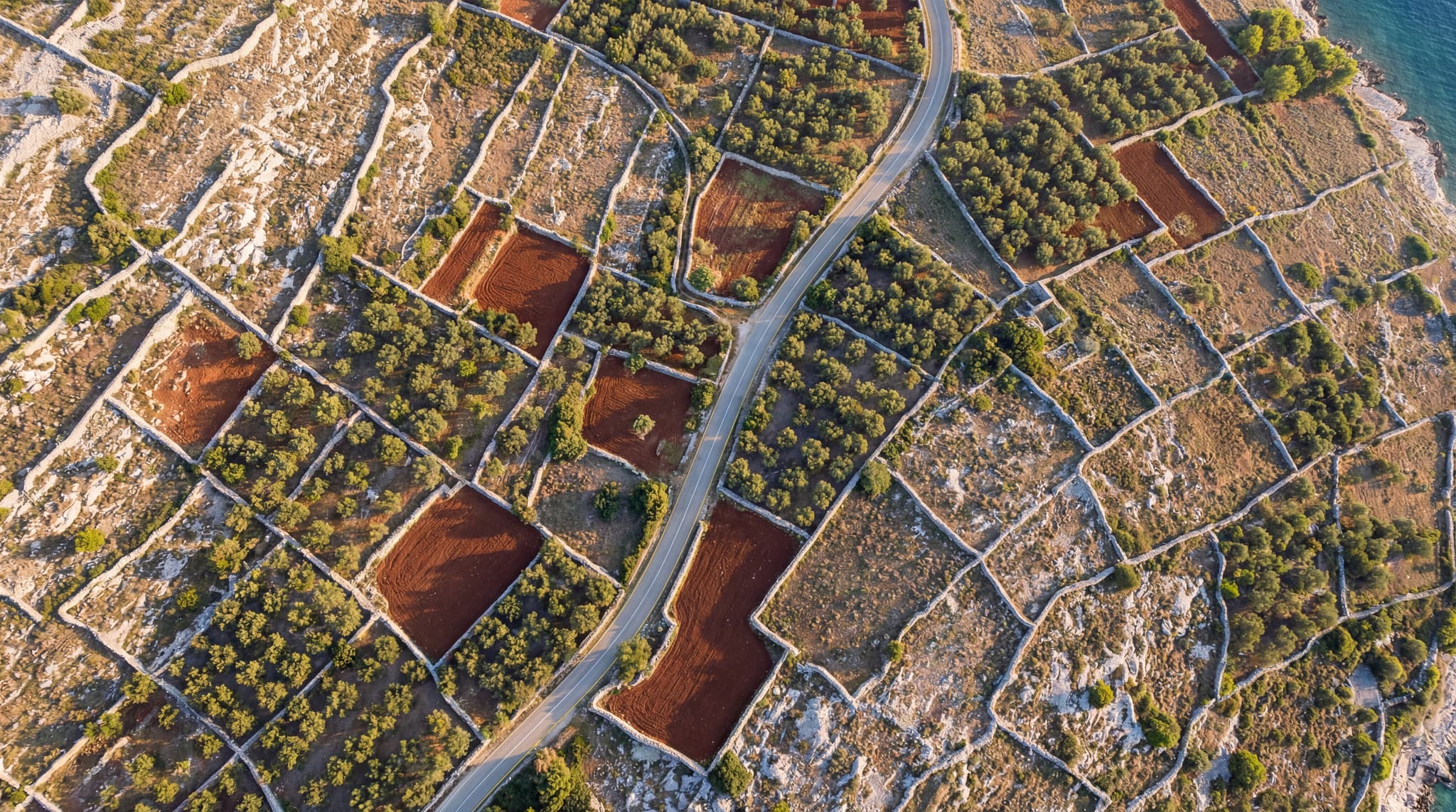
Geodetic survey and preparation of base maps for delineating the maritime domain boundary along the Istria County coastline, supported by extensive drone imagery.
A selection of our completed geodetic and surveying projects.
Geodetic survey and preparation of base maps for delineating the maritime domain boundary along the Istria County coastline, supported by extensive drone imagery.
Comprehensive geodetic services throughout the construction of the Bjelovar Wastewater Treatment Plant (WWTP) – from staking out to as-built documentation.

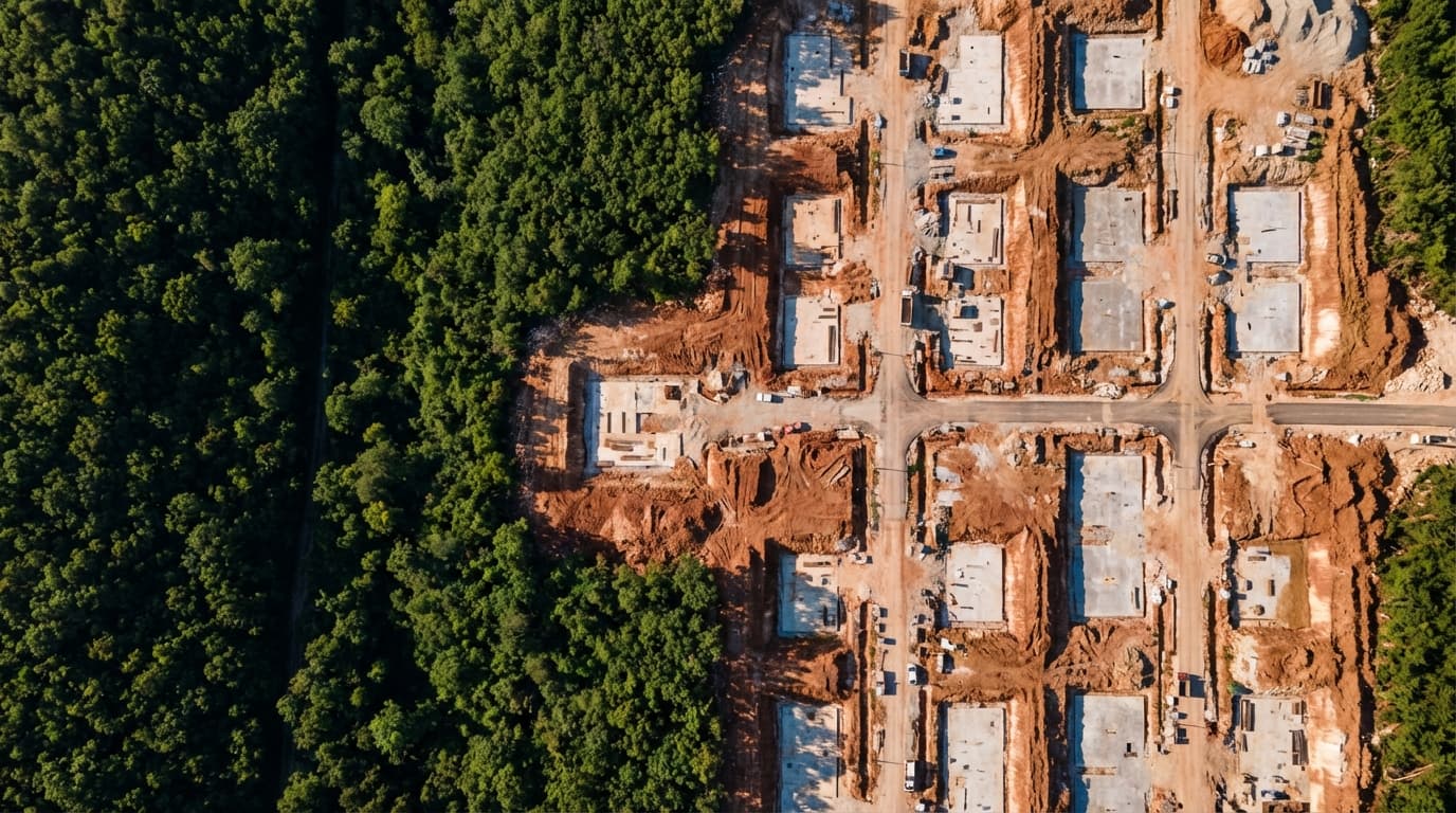
Geodetic survey and earthworks quantity verification using drone mapping – comparison of pre- and post-construction conditions.

Geodetic survey report and supporting documentation for registering a pre-1968 building in the cadastre and land registry.

LiDAR scanning and digital terrain modelling of torrential streams in the Podgora Municipality area for flood protection planning.

Geodetic measurement and quantity verification for façade works – precise determination of completed façade surface areas.

Supervision of extraordinary maintenance of an unclassified road, Drežnica – Tomići section, approx. 1.0 km long